By Marc Pfeiffer and Lucas Marxen
The NJ MOD IV Historical Database is an online, searchable database of New Jersey MOD IV parcel information data sets from 1989 to 2022. Providing land parcel and property ownership data, the MOD IV database consists of more than 93 million records spanning 33 years. After an extended beta test period, this database is now fully available to the public.
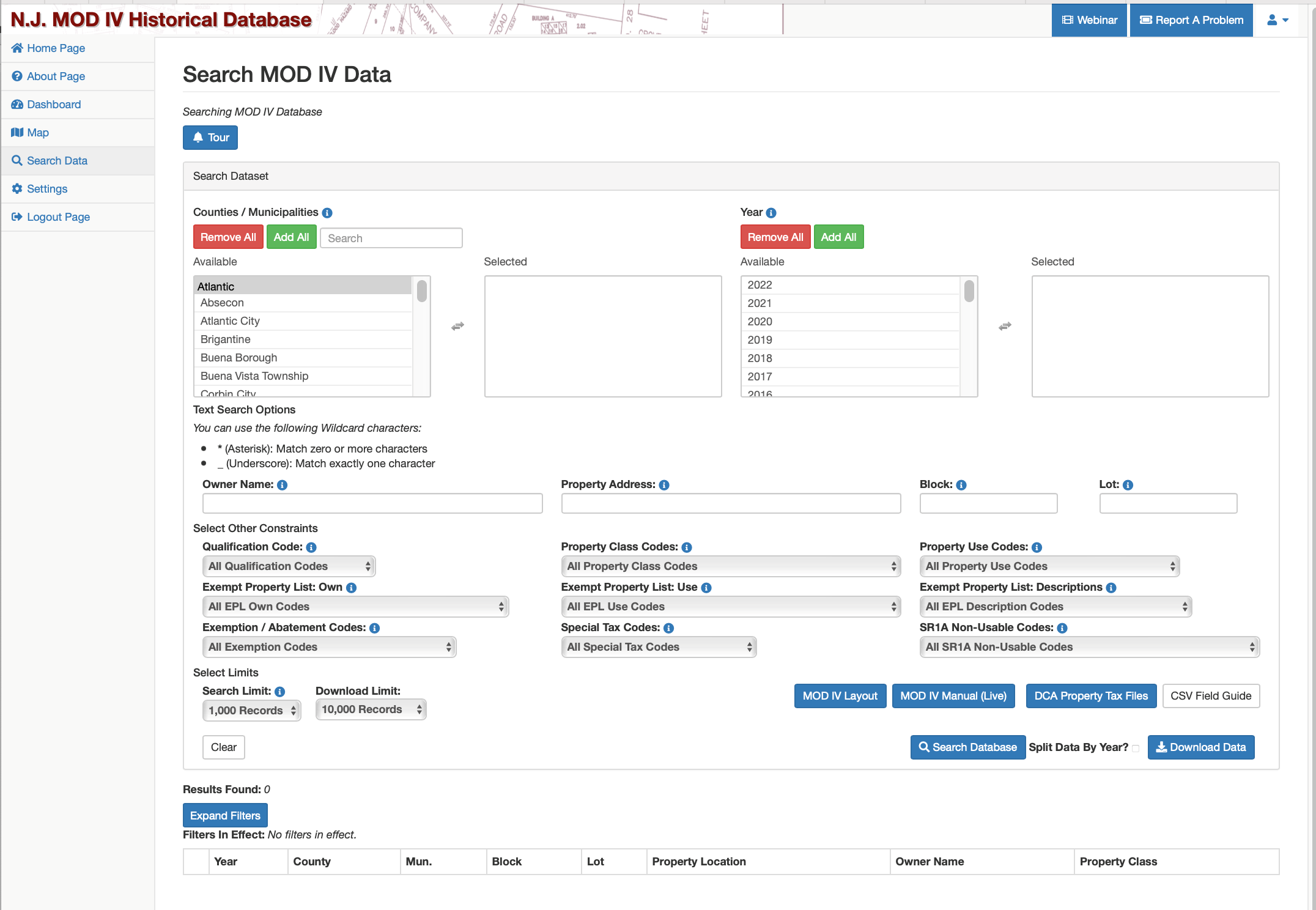
Source data comes from individual municipal assessors, is aggregated at the county level by the 21 individual county tax boards, and the 21 county files are then consolidated by the NJ Division of Taxation. This database allows searches by year, county, municipality, address, block, lot, ownership, and nine MOD IV classification variables. (A MOD IV user manual permits users to interpret and search using MOD IV codes.)
Additionally, the browser-based site includes a GIS map so users can select a group of parcels and display their data online or downloaded as a CSV file. This database serves as a core element of many GIS mapping applications that link parcel information with mapping and geocoded data. The application also allows viewing of a single lot over multiple years — regardless of whether the record changed in some way (subdivision, renumbering, etc.). This database provides the added value of historical data and datasets that have been cleaned of extraneous data that had vexed MOD IV users over the years. One limitation is that the database is updated annually, so it does not reflect real-time information.
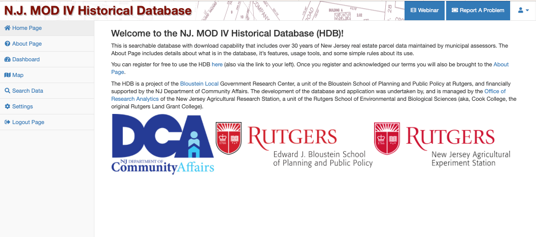
The data is regularly used by a wide range of academic researchers, government agency policy makers and analysts, and commercial and non-profit sector users. Registration is required for free access to the system, available here. The landing page and search screen are shown below. Links to a feature tour and use webinar are on the site. The “Report a Problem” button allows users to report any bugs or odd data. While a good deal of effort has been spent on cleaning data, random oddities might still be found. Users are asked to report them, along with site suggestions and their use cases. Users can email questions and comments to Bloustein.Local@rutgers.edu.
The NJ MOD IV Historical Database is a partnership of two Rutgers units: the Bloustein Local Government Research Center at the Bloustein School of Planning and Public Policy, and the Office of Research Analytics (ORA) at the New Jersey Agricultural Research Station. It is managed by Marc Pfeiffer, MPA, Assistant Director of Bloustein Local and Lucas Marxen, MCRP, MS Comp Sci., Associate Director of the ORA. The application developer is ORA’s Daniel Farnsworth, BS Comp Sci. We would like to gratefully acknowledge the New Jersey Department of Community Affairs for funding the development of this project.


